Rwenzori Mountains National Park
Africa’s legendary “Mountains of the Moon” with snow-capped peaks and glacier trails
Africa’s legendary “Mountains of the Moon” with snow-capped peaks and glacier trails
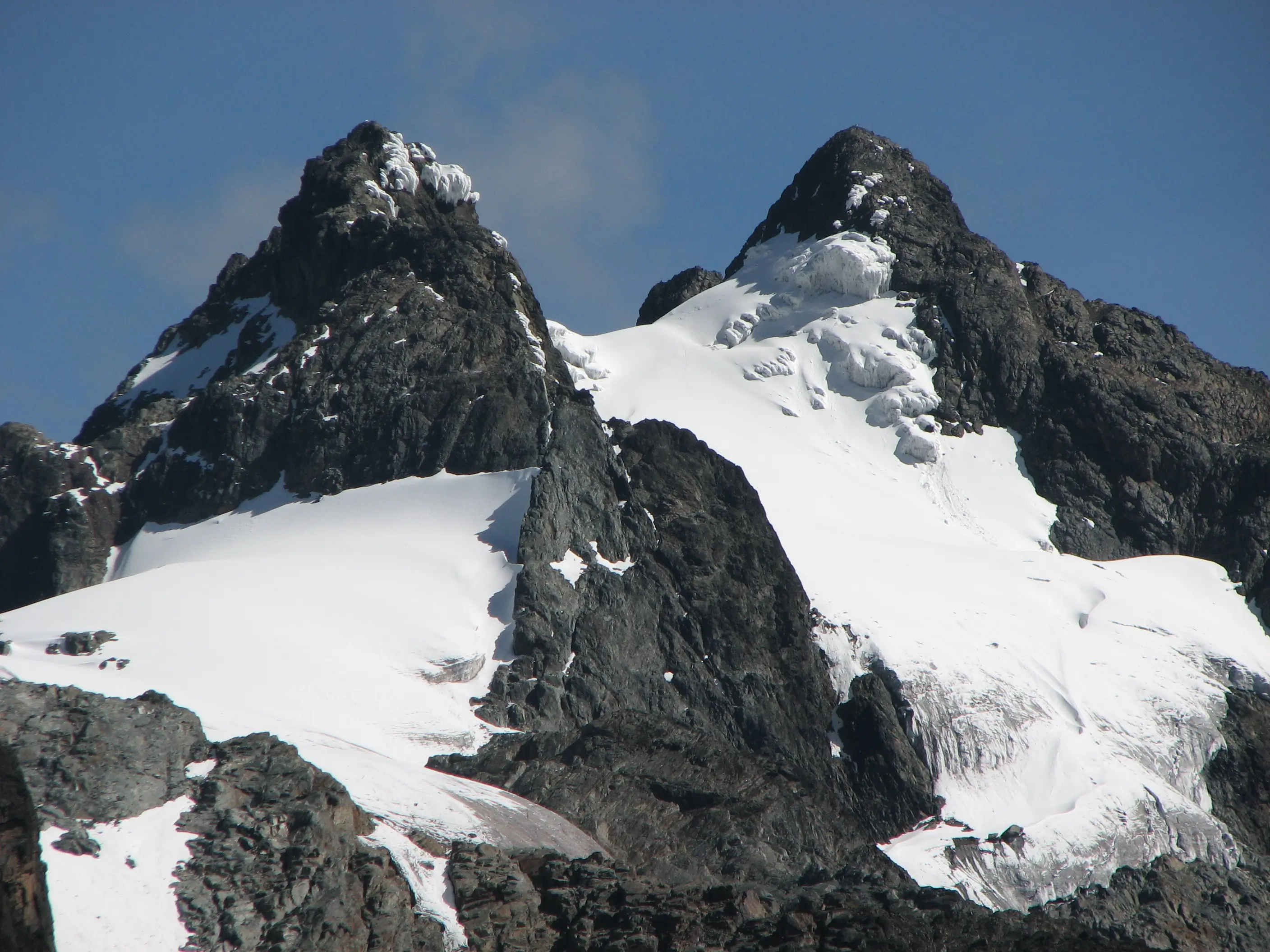
Rwenzori Mountains National Park, located in western Uganda along the border with the Democratic Republic of Congo, spans 996 square kilometers and encompasses the fabled “Mountains of the Moon.” The park is centered around the Rwenzori massif, which includes Africa’s third-highest peak, Margherita Peak (5,109m).
The park’s diverse ecosystems range from tropical rainforests to alpine meadows and glaciers, supporting over 70 mammal species, 217 bird species, and unique flora like giant lobelias. It is a UNESCO World Heritage Site, recognized for its ecological and geological significance.
Renowned for its challenging trekking routes, the park attracts mountaineers and adventurers seeking to explore its rugged terrain, pristine lakes, and cultural heritage of the Bakonzo people.
Rwenzori Mountains National Park offers a world-class mountaineering experience, with treks through lush forests, past waterfalls, and up to snow-capped peaks. The park’s Central Circuit Trail and Kilembe Trail lead to Margherita Peak, offering breathtaking views and encounters with unique alpine flora.
Wildlife includes forest elephants, duikers, and rare birds like the Rwenzori turaco. The park’s glaciers and high-altitude lakes, such as Lake Bujuku, add to its allure, while cultural interactions with the Bakonzo community enrich the experience.
Trekking in the Rwenzoris is a multi-day adventure, with the Central Circuit Trail (7-9 days) being the most popular route to Margherita Peak. Treks start with a briefing at Nyakalengija or Kilembe, followed by guided hikes in groups of up to 8, supported by porters and experienced mountaineers.
Shorter treks, lasting 1-3 days, explore lower slopes and forests, offering scenic views and wildlife sightings. Climbers spend time acclimatizing and navigating challenging terrains, with campsites providing rest stops amidst stunning landscapes.
Rwenzori Mountains National Park offers diverse experiences across its key areas:
Main route to Margherita Peak with glacier views
Alternative route with pristine lakes and peaks
Starting point for treks and cultural visits
Alpine zone with lakes and unique flora
380 kilometers (236 miles)
996 sq km (384 sq mi) of mountainous terrain
1,200 to 5,109 meters (3,937 to 16,762 ft)
1991 (National Park status)
World Heritage Site (1994)
Forest elephants, Rwenzori turaco
217 bird species
70 mammal species
Unique alpine flora
$35 per person per day (Foreign Non-Residents)
$25 (Foreign Residents)
UGX 15,000 (East African Residents)
Explore lower slopes for wildlife and flora
Meet Bakonzo communities for cultural insights
Spot 217 species, including Rwenzori turaco
Challenge steep cliffs with expert guides
Briefing at Nyakalengija or Kilembe. Pack warm clothing, rain gear, and trekking poles. Porters available.
Treks last 1-9 days, with steep, muddy trails. Groups of 8 max, led by expert guides. High-altitude camping.
See glaciers, lakes, and unique flora. No flash photography. Enjoy panoramic summit views.